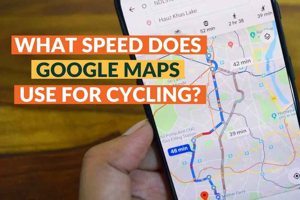
Google Maps usually assumes that you are moving at an average speed of about 16km/hr or about 10 mph.
Note that Google Maps cycling speed usually will not take into account the length of the journey or times you may take for refreshments checking directions or any other distractions. Still, it does take into account things such as traffic stops, rail crossings, and traffic lights.
However, when it comes to Google Maps bike speed, it is the experience of many people that they tend to finish their ride before their Google Maps Estimated time of arrival (ETA). The reason for this is that there are many other factors at play that Google Maps may not take into account.
How Accurate are Google Maps Cycling Directions
Google Maps tends to be quite accurate when it comes to offering directions. However, it is important to remember that it is not perfect and hence you should double-check the route just to be sure.
Google Tends to be accurate when it comes to:
Is google maps bike time accurate
Google Maps will often provide cycling directions and provide an estimation of your ETA. If you are a relatively fit cyclist, you may find the ETA times to be quite slow.
For instance, Google Maps may estimate a hilly 30-mile ride to take three hours at 10 miles an hour which can be fine if you are on a mountain bike but if you are on a road bike you can do it at an average speed of between 14 to 16 miles an hour.
Are Google Map Routes Accurate
One of the best things about Google Maps is that it will recommend routes that avoid heavy traffic such as interstate and divided highways on which bikes may not be allowed.
Overall using Google Maps offers the best routes particularly when you are not too familiar with an area. You can always zoom into the map and find alternative routes other than the first route that was presented by the app.
Why You Can’t Completely Rely on Google Maps?
Google Maps bicycle speed fails to consider several variables when determining the estimated ETA times. In addition to using an average speed of about 10 mph for every rider regardless of riding ability, the software does not presume that you may decide to take a voluntary stop along the bike route.
Google Maps usually does not factor in the several breaks you may take mid-ride or the time you may stop to check your map and route. Moreover, the app also assumes that every rider is a law-abiding citizen who will wait for the light to go green even if the roads are clear and it is safe to cross.
The software also does not consider the route surface conditions and weather. It also assumes that riders will reach their destination at the same time despite heavy snowfall, downpours, snowfalls, and other changing road conditions.
In some instances, Google Maps considers off-road bike routes to be faster than on-road bike trails but most of the time that is not the case. It also tends to be very bad at finding the best routes you should take.
Google Maps is similar to Waze as it only displays the quickest bike paths and will not take into account the preference of a cyclist. For instance, you may prefer to take an easier or quieter route over a noisier but quicker trail.
how does google maps calculate bike time?
Google Maps makes use of Global Positioning System (GPS) data from phones using Google Maps to estimate the speed and movement of traffic in real time.
The data is what the Google bike speed algorithm uses to make an ETA estimate as it will increase average speeds when traffic conditions are clear and increase speeds when there is high traffic.
Google Maps also makes use of historical traffic patterns and posted speed limits in its estimation of ETAs.
When you first enter your destination into the App, the original ETA has to do with the distance between your starting point and the destination, current traffic conditions, and posted speed limits.
Once you start the ride, the app will usually update your ETA and average cycling speed based on a combination of these factors.
Does Google Maps Adjust Cycling Speed?
Google Maps sometimes alters the cycling speed estimate for the different parts of the route based on factors such as the number of intersections and gradients and sometimes the GPS data logged by other users of the Google Maps software may be taken into account.
However, it is important to note that your cycling speed on Google Maps will not be adjusted due to:
- Weather conditions
- Time of day (and so the amount of congestion)
- Traffic lights – it assumes all cyclists wait until red lights turn green
- Route surfaces (e.g. off-road cycle paths, bumpier, less even terrain)
- How fast you cycle on average
According to a former Google engineer, Google Maps makes use of recommended speeds, official speed limits, road type, historical average speed data by other users, and real-time traffic information in calculating ETAs.
How Do I Use Google Maps to Ride a Bike?
If you have been intending to become more environmentally conscious or just need to get some exercise, you can use Google Maps to go almost anywhere you want in the United States.
Here is how you can use Google Maps to ride a bike:
- Go to Google Maps at http://maps.google.com.
- Select Get Directions.
- Type your starting address into field A.
- Type your destination into field B.
- Click Bicycling on the dropdown menu.
- Click Get Directions.
- Click on your chosen route. Google Maps will usually suggest several, in order from shortest to longest trip. Some routes may take slightly longer but may be preferable for other reasons, such as avoiding rough terrain or busy intersections.
- Customize the route by dragging the blue line (your bike route) wherever you want to move it to
The Google Map usually color codes the routes as follows:
- Dark green lines are trails specifically designed and set aside for cycling
- Bike lanes on city streets are marked with light green lines
- Dashed green lines are other recommended routes for cyclists
In addition to being able to see the bike route on the map, a cyclist can also:
- Check the left of the map for step-by-step directions to your destination
- Select Street View to switch between aerial view and street-level view
- Click Local Search to find places where you can get your bike repaired or take pit stops.
You can also explore all manner of bike paths in the area by going to the More Menu.
Is Google Maps Good For Cycling?
Google Maps is good for cycling as it provides several routes giving you a very good estimate of how long each will take. Nonetheless, it is important to note that Google Maps is not perfect due to the reasons given above.
Google Maps tends to have a sense of uniformity when it comes to ETAs though they are rarely wildly inaccurate, they are not tailored to individual riders or specific factors as mentioned above such as traffic or weather.
However, Google Maps tends to be pretty reliable and over the years there have been many improvements including visual overhauls which have come from satellite imagery that are added in through an algorithm that tries to decipher the nature of the topography and environment.
In the latter part of 2020, Google Maps added a messaging function that makes it easier for verified businesses to directly communicate with customers right from the software. Its performance insights have also been regularly updated and now include a Community Feed and Street View contributions straight from a rider’s phone.
To make the software more eco-friendly, Google Maps now defaults to the route that has the lowest carbon footprint as opposed to what may be the fastest.
Google Maps Alternatives for Cycling Routes
If you are no longer interested in using Google Maps or believe it is not sufficient for your needs, you will be glad to know that there are too many alternative apps that you can resort to. Google Maps is easy to use and for some, it provides the most up-to-date data, but to some, it may feel that it logs too much information about the user.
As such, if you are looking for something more under the radar, niche or private, these are just some of the few recommendations out there:
- Apple Maps – This is a great app if you are using iOS and surprisingly it is one of the most privacy-focused apps on this list. It is not linked to your Apple ID nor does it retain any cycling history, searches, and saved locations. Moreover, it makes use of end-to-end encryption which means even Apple cannot view the data.
- OpenStreetMap – This has often been called the Wikipedia of maps as users can usually update it through aerial photography, GPS devices, and individual manual changes. It comes with no frills does not have ads or logins and only collects a limited amount of data. The only negative is that it does not have an official app that you can install on your smartphone
- OsmAnd – best for when you’re looking for previous users’ experience, it uses the OpenStreetMap database, which allows them to provide more precise live traffic updates. Available both online and offline, it’s also free with a Premium subscription from $1.99 a month. It also has tools to change the look of maps, ‘dark mode,’ and Wikipedia integration.
- CycleStreets – a UK-wide, non-profit journey planner, which offers a choice of four different route modes based on the type the user prefers. It also saves previous routes, tells you how many calories you’ll burn on a route, as well as how many traffic lights you’ll come across and how busy it is.
- Bike Citizens – an app which, through logging its users’ journeys, will then suggest the best routes for you, or help you explore a new city through a ‘cycling tour’ curated by the area’s regular riders.
